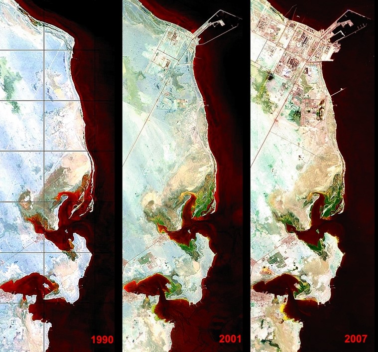
In order to support future development of coastal infrastructure and landuse zoning, Anthesis UMR used their proprietary remote sensing technology DRYSATMAP® to assess changes in coastal morphology, sediment distribution and biodiversity. As part of this work, the Anthesis UMR team evaluated potential future changes associated with climate change-related effects which were reflected in land use zoning considerations.
The images below show the changes noted in the study area from 1990 to 2007 with the sediment regime within the coastal currents depicted in red, the increase in shrub vegetation in light green, salt-tolerant species shown in olive green and salinized surfaces in yellow.